In This Story

According to scientists, the Chesapeake Bay region has one of the highest rates of water level rise in the U.S., due to sea-level rise and sinking land. In the next 30 years, scientists predict that Maryland may see as much as an additional two feet of sea-level rise. Maryland’s coastline, however, has an abundance of habitats that can help mitigate the effects of sea-level rise, including marshes and submerged aquatic vegetation.
Celso Ferreira, associate professor from the College of Engineering and Computing, has teamed up with Maryland’s Department of Natural Resources and the Nature Conservancy to predict the effects of sea-level rise and consider strategies to address the situation as part of a three-year $738,000 grant from the National Oceanic and Atmospheric Administration (NOAA). The project, called “Quantifying the benefits of natural and nature-based features in Maryland’s Chesapeake and Atlantic Coastal Bays to inform conservation and management under future sea-level rise scenarios,” will measure the water levels and the wave energy during extreme events in various locations along Maryland’s extensive shoreline.
“The base sea level is going up and of course when a hurricane, Nor’easter, or a regular storm hits the Chesapeake in the future, the water level is higher, and we expect to see more flooding,” says Ferreira. “The other thing we are investigating is coastal marshes and the protection they provide to the coastline.”
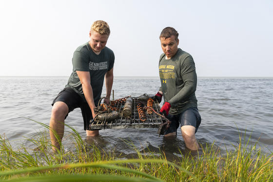
The team uses sensors, placing the instruments in the water so they can measure the storms of today and collect information about the protection the natural areas are providing. After the researchers download the data, they use computer modeling to extend that data into a future time. As they do this, the team runs a variety of climate change scenarios.
Ferreira says the biggest limitation is that they can’t physically and financially put sensors across the entire state. That’s where the other stakeholders come in. “We rely on stakeholders to help us decide the most representative and strategic locations that we should be monitoring,” he says, “So, there are six and there is a lot of generalization that we do. That’s where the computer modeling comes in.”
The team will be measuring living shorelines, the marsh, different types of vegetation, freshwater marsh, saltwater marsh, and the coastal bays. To do this they rotate the sensors around to collect data that provides the information they need. Due to underwater conditions during extreme events, and because they do not have telemetry equipment, the team must travel to the marshes to place the sensors, retrieve them, download their data, and then replace them.
In a pilot study from Deal Island, Ferreira and his team discovered that depending on the size of the wave and the amount of water, marshes can absorb up to 90 percent of wave energy. “If it’s a huge wave and a lot of water you don’t get 90 percent,” he says. “One of the things that we’re studying is how that protection is changing with climate change. We think when there’s more water, the protection lessens.”
The results from the project will help Maryland’s Department of Natural Resources assess the various scenarios and develop strategies to effectively cope with the situation.
“In a nutshell, the work will give us a window into the future, to see what kind of protection we can expect and that’s going to offer the state information so that they can proactively prioritize adaptation strategies,” says Ferreira.
